This is my city! Click here!
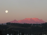
Heroica Puebla de Zaragoza is the main city; I live where it says Cholula de Rivadavia. The two volcanoes to the west are Popocatepetl and Iztaccíhuatl, and the one to the east is La Malinche, which we (almost) climbed a couple months ago.
Here is the first house I lived in: Click here
It was located roughly in a municipality called San Antonio Cacalotepec, the latter part meaning (in Nahuatl) "Hill of the Ravens". I'll give an explanation of the Mexican city/town naming system on my blog in a bit.
If you'll zoom out a bit, take a look at the intersection of 24 de Febrero and 24 de Febrero. The little street only has a name for the sake of having one in Google Maps, there's no sign or anything. To go anywhere, I walked from the house to that intersection, then, following the yellow 24 de Febrero, to the highway Federal Puebla-Atlixco to take a bus to the NE, and from there to more places. A great way to learn!
Here is the house I live in now, it's the one above the wondeful name of my street. Put your fingers on the name John F. Kennedy, and move them to the NW until you touch a house. That's mine! If you'll zoom out, you can see the street I walk to get to La Recta (here they call it Ruta Quetzalcoatl, which is OK too), which is where the buses pass.
I don't know where my third house will be, but now is the fun part! I hope you all have Flash Player installed, and that you know how to use Google Street View, because this is the more interesting part. These are some of my favorite places in México.
Here is El Centro of Puebla, centered around a zócalo, or center square, a fixture in every Mexican city, and any one with Spanish influence. The first thing you see is the Cathedral of Puebla, which is a really intimidating and powerful building that has a great sense of serenity in the middle of the city. Here are some looks at the inside, intricately decorated and amazing to stand in.
A little bit to the left, and you'll see the zócalo, a really neat park with huge trees and a beautiful fountain in the middle of it. Even further to the left and you'll see the portales, which can be found in pretty much any city in México. in there are some really neat restaurants and shops. I encourage you to "walk around" with the Street View camera to get a picture of how neat it is around el Centro.
Here is El Parián, a really cool market downtown, where handmade pottery, clothing, tourist stuff, candy, furniture, etc., is sold. The SV function doesn't really do it justice, so i would recommend zooming out, grabbing the little orange man again, and then placing him on some of the blue dots that appear. They represent photographs of the inside of the market, really amazing.
This is the zócalo of San Pedro Cholula, a place where I go to relax and write, about a 20 minute bike ride from my house. As you can see, the main plaza, with the Mexican flag and portales, is accompanied by a nice shady park with huge trees. There a huge markets, or tianguis, which, apart from having a great Wikipedia article, are put up on the weekends, where anything you could ever want is sold. Check out the other side as well. As before, it's definitely worth it to zoom out and put the little man on the blue dots.
I hope you enjoy these photos, and trust me, some of mine will but uploaded soon! I hope you're all enjoying yourselves, and I send you all much love from México.


